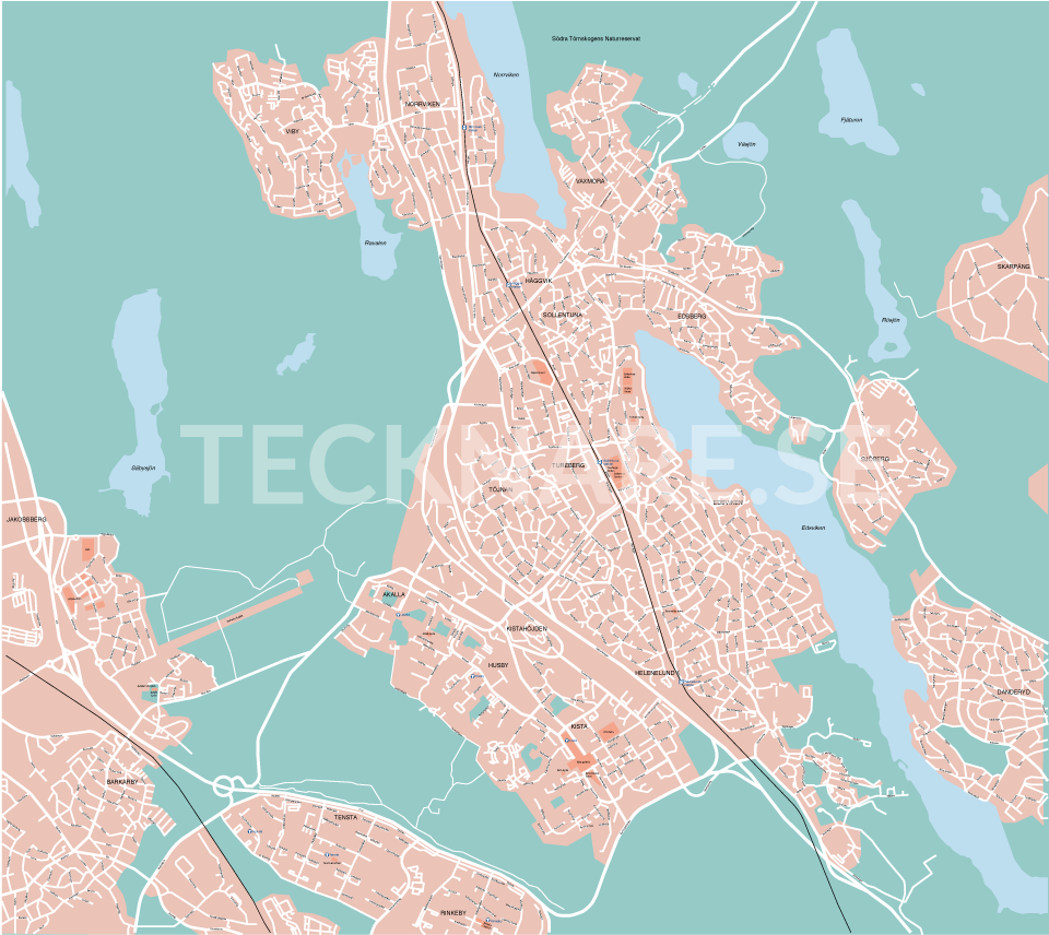
Original map drawing for a tourism and events company.
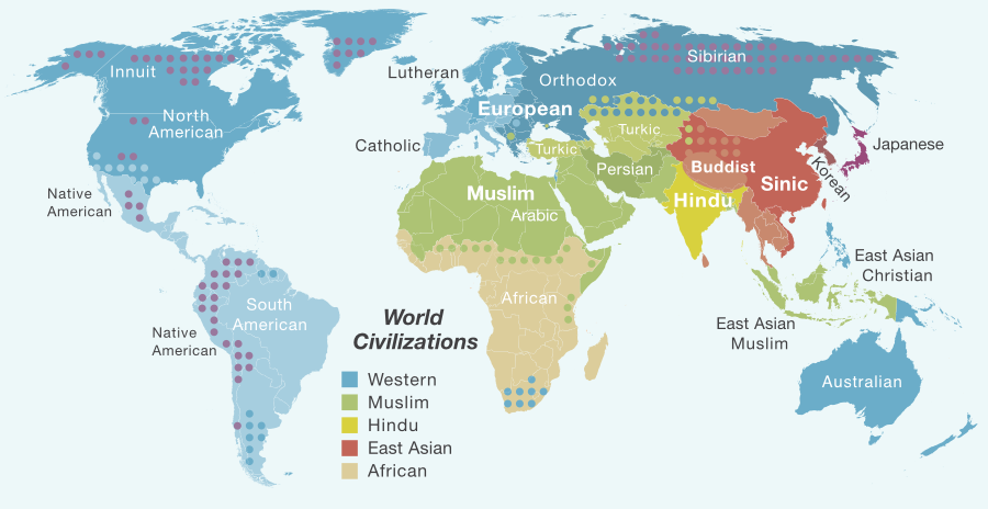
Simple version of the religious and cultural divide of the world, illustration for a blog.
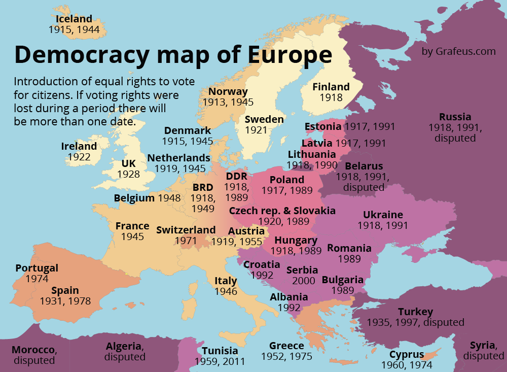
Democracy map of Europe, when democracy was introduced and lost. For a blog on politics →
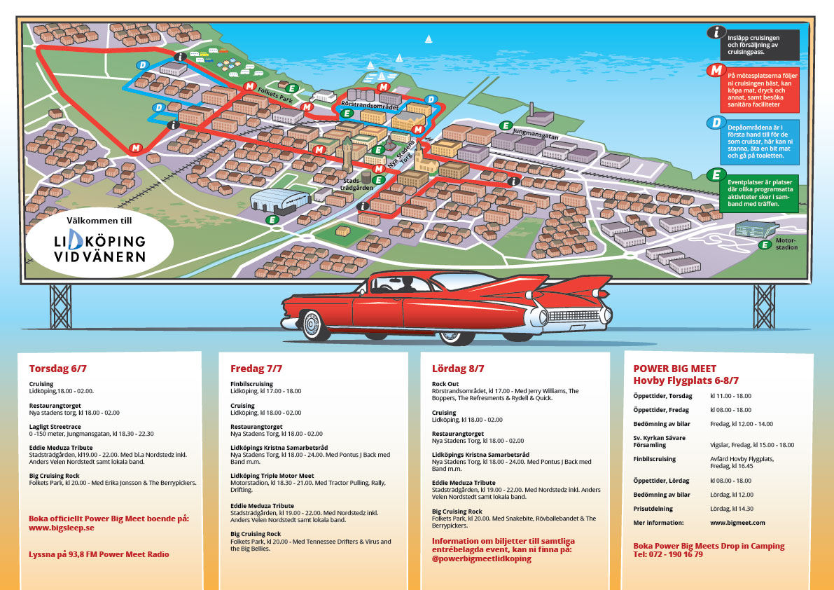
Representatives for the town of Lidkoping in Sweden asked me for an illustrated map, including →
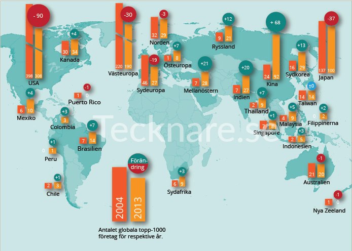
World Map to Nima Sanandaji and Maria Rankkas book The New Geography of Success Enterprising. →
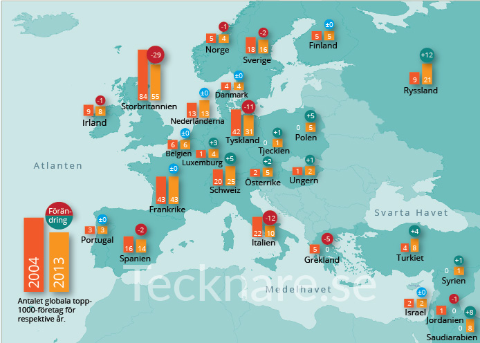
Europe Map to Nima Sanandaji and Maria Rankkas book The New geography of Success Enterprising. →
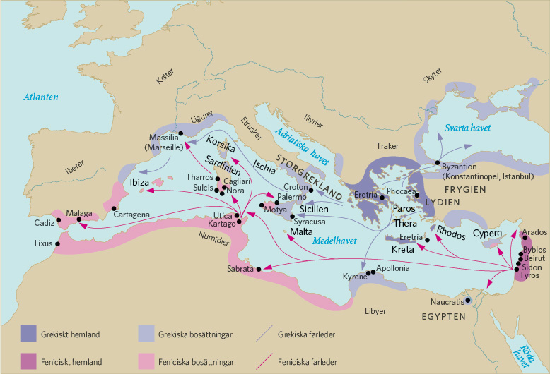
Informative map explaining the Greek and Phoenicians trade and colonization routs in the Mediterranean →